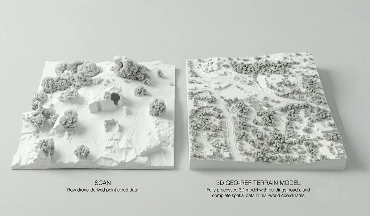
Digital Site Model
„set the ground for design”

ABOUT THIS SERVICE
A precise, terrain-accurate 3D model of your site and its surroundings, built from drone and geospatial data. It captures the real shape of the land, existing context, and key spatial conditions giving you a reliable base to start designing with confidence.
This is a lightweight, geometry-focused model designed for early-stage design, planning, and communication. It is not a BIM model, but a clear and accurate representation of what is physically there.
YOU RECEIVE
-
Georeferenced 3D mesh or point cloud
-
Rhino / SketchUp / Revit-ready formats
ENHANCE IT WITH
Orthophoto + contour map

High-precision base layer combining aerial imagery with terrain contours, ideal for understanding site topography and elevation at a glance.
High-resolution heightmap terrain model

Detailed terrain model ready for further modelling and visualization workflows.
Building footprints and basic massing

Initial volumetric context showing existing or potential built forms, helping you quickly grasp scale and spatial relationships.
Organized Site Layers
Clearly structured layers for buildings, roads, water, and key site elements, making the model easy to navigate and use.